
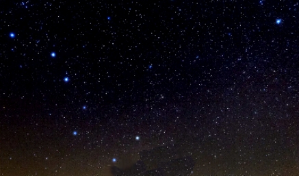
   Because Polaris, the North Star, is situated in the sky almost directly aligned with Earth's northern axis, the star (found by extending an invisible line from the cup of the Big Dipper upwards) is always in the north. Mariners have known this for thousands of years. 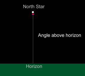 What is not so well known, but was a piece of information vital to ocean-going explorers in past centuries, is that the angle measured from the horizon up to the North Star, regardless of where you are in the northern hemisphere, will be your latitude on the globe of Earth.
Latitude is measured from the equator (latitude = 0°) northward to the north pole (latitude = 90°). The latitude of Edmonton, Alberta is about 54°. In Edmonton, Polaris will be 54° above the horizon. We'll show you why your latitude is the same as the height of the North Star in the sky (which remains constant where you are because all the other stars appear to rotate around it as the Earth turns). 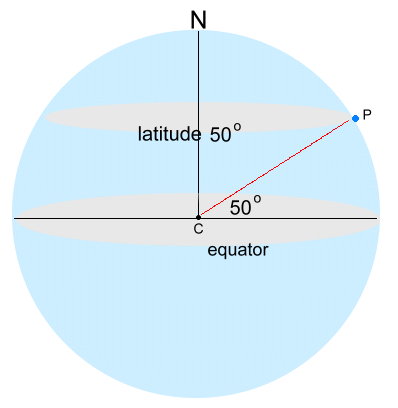 First, some information about latitude. It's a measure of how far north (or south) you are, and is displayed on a globe or map as parallel lines.
 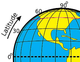 For example, on the map, the latitude lines are horizontal; the 49th parallel is the line between the US and Canada in red. For example, on the map, the latitude lines are horizontal; the 49th parallel is the line between the US and Canada in red. On the globe at the far right, you can see how latitude is determined; a person at point P would be at a latitude as measured from the centre of the Earth of 50°. 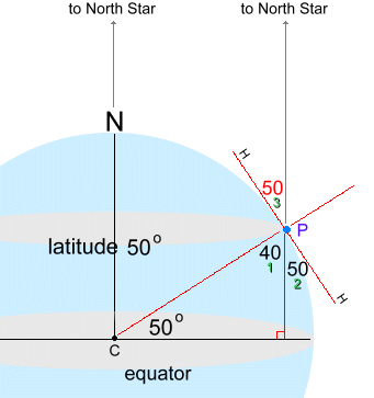 So why is this the same as the height of the north star above the horizon? Have a look at the globe:
Notice that the sight lines to the north star from person P and from the north pole are essentially parallel; this is because stars are so far away. In the right triangle made from the latitude angle of 50°, the angle at P is 40° (1). This means angle 2 must be 50°. Because angle 3 is vertically opposite, it's also 50°. Now look at what angle 3 is measuring; it's the angle between the horizon line H and the north star! So the latitude angle is the sme as the north star height. For explorers hoping to figure out their position on a map while they were in the middle of the ocean, their latitude was easily determined by measuring the angle from the horizon to the north star, using an astrolabe, and later a sextant. Longitude was a different story; its measurement needed the invention of an accurate clock. The purpose of a clock at sea is to measure accurately the time of a known event, and compare it to the same event back on land. As the Earth rotates at a regular predictable rate, the time difference between the event listed in a table and the ship's local time can be used to calculate the longitude of the ship relative to the Prime Meridian (defined as 0° longitude). For example, the farther West you are, the earlier the sun rises. Practical celestial navigation required a marine chronometer to measure time, a sextant to measure the angles, an almanac giving schedules of the coordinates of celestial objects, (eg: sun rise times) and a chart of the region. The creation of a timepiece which would work reliably at sea was difficult. Until the 20th century, the best timekeepers were pendulum clocks, but both the rolling of a ship at sea and the up to 0.2% variations in the gravity of Earth made a simple gravity-based pendulum useless both in theory and in practice. In 1714, the British government offered a longitude prize for a reliable timepiece that would allow determining longitude at sea, with the awards ranging up to Ł20,000 ($3.4 million Cdn in 2024 terms). It was finally won by John Harrison in 1761. His design used a fast-beating balance wheel controlled by a temperature-compensated spiral spring. These features remained in use until stable electronic oscillators allowed very accurate portable timepieces to be made at affordable cost in the 20th century. |